Alabama condition guide
Alabama Coastal Plain Geothermal Installation Guide
A homeowner-focused guide to geothermal planning in Alabama’s Coastal Plain, including sandy and loamy soils, drainage, water-table concerns, Gulf/coastal influence, southern Alabama property conditions, and loop-type screening.
The Alabama Coastal Plain is a broad southern Alabama setting, not a single uniform soil type. One property may have sandy or loamy soils that drain quickly; another may have poorly drained flats, seasonal wetness, stream-adjacent areas, filled ground, pond margins, or shallow groundwater. For geothermal installation, those differences affect site evaluation, loop-field planning, trenching or drilling logistics, water-source caution, yard restoration, and homeowner questions.
This guide builds on the national geothermal installation guide and the Alabama geothermal installation guide. It focuses specifically on the Coastal Plain context for southern Alabama homeowners. Use it with the Alabama geothermal installers directory when comparing contractors.
Quick-scan summary for Alabama homeowners
Guide navigation
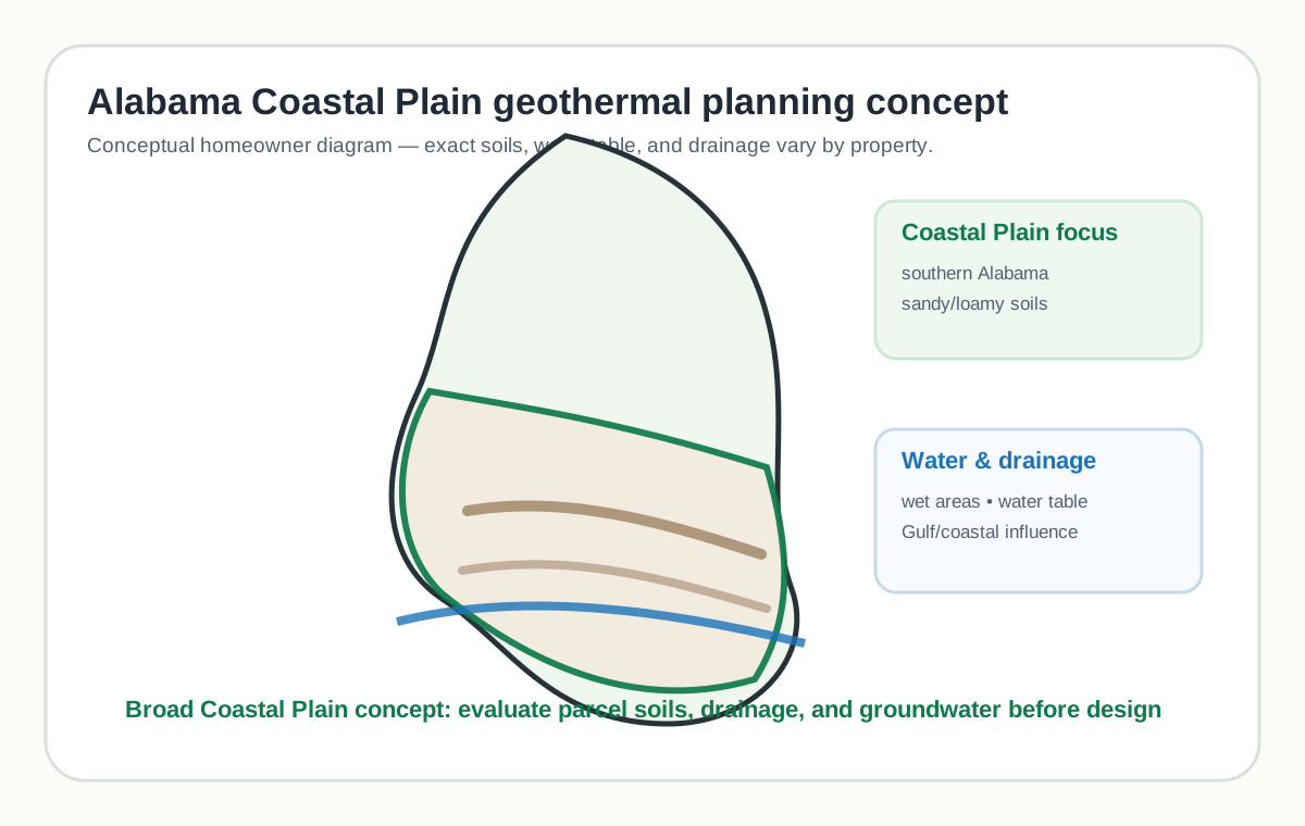
Alabama Coastal Plain map / diagram
Why the Coastal Plain changes Alabama geothermal planning
The Coastal Plain matters because it frames the kinds of questions a homeowner should ask before choosing a geothermal installer. Southern Alabama properties may include sandy or loamy surface soils, clayey layers, low drainage areas, forested lots, farm fields, pond edges, filled lots, coastal-influenced stormwater patterns, or shallow groundwater. Each of those conditions can affect the outdoor portion of a geothermal project.
Geothermal systems are designed around the home load and the ground or water heat exchanger. The Coastal Plain does not override the load calculation, but it can affect how the loop field is installed, which loop types deserve review, how much surface disturbance is expected, whether water-source ideas require extra caution, and how the homeowner should compare proposals.
Homeowners should look for site-specific reasoning. A proposal should not say only that the home is in southern Alabama. It should explain what the installer observed on the parcel, what soil or water resources were reviewed, what assumptions remain, how outdoor work will be tested, and what documentation the homeowner will receive after installation.
The 13-step geothermal installation process adapted for Alabama Coastal Plain properties
1. Project goals and home suitability

For Coastal Plain properties, this step should connect comfort goals to southern Alabama site conditions before choosing a loop concept. The point is not to stereotype every southern Alabama parcel; it is to make the installer explain how broad Coastal Plain conditions and the actual property review affect the plan.
Ask: What did you observe or verify about soils, drainage, groundwater, flood exposure, equipment access, septic, wells, and restoration for this step? Red flags: generic statewide advice, no site walk, no water-table discussion where conditions suggest it, or no written testing and documentation plan.
2. Load calculation and energy analysis
For Coastal Plain properties, this step should size the system from the home load while treating Coastal Plain soils and groundwater as design inputs. The point is not to stereotype every southern Alabama parcel; it is to make the installer explain how broad Coastal Plain conditions and the actual property review affect the plan.
Ask: What did you observe or verify about soils, drainage, groundwater, flood exposure, equipment access, septic, wells, and restoration for this step? Red flags: generic statewide advice, no site walk, no water-table discussion where conditions suggest it, or no written testing and documentation plan.
3. Site evaluation

For Coastal Plain properties, this step should review sandy or loamy soils, poorly drained pockets, wetlands, floodplain context, wells, septic, trees, utilities, and access. The point is not to stereotype every southern Alabama parcel; it is to make the installer explain how broad Coastal Plain conditions and the actual property review affect the plan.
Ask: What did you observe or verify about soils, drainage, groundwater, flood exposure, equipment access, septic, wells, and restoration for this step? Red flags: generic statewide advice, no site walk, no water-table discussion where conditions suggest it, or no written testing and documentation plan.
4. Loop-type screening

For Coastal Plain properties, this step should compare loop options without assuming the Coastal Plain automatically means water-source geothermal. The point is not to stereotype every southern Alabama parcel; it is to make the installer explain how broad Coastal Plain conditions and the actual property review affect the plan.
Ask: What did you observe or verify about soils, drainage, groundwater, flood exposure, equipment access, septic, wells, and restoration for this step? Red flags: generic statewide advice, no site walk, no water-table discussion where conditions suggest it, or no written testing and documentation plan.
5. Equipment and system design review
For Coastal Plain properties, this step should review indoor equipment, condensate handling, ductwork, equipment elevation, and service access separately from outdoor soils. The point is not to stereotype every southern Alabama parcel; it is to make the installer explain how broad Coastal Plain conditions and the actual property review affect the plan.
Ask: What did you observe or verify about soils, drainage, groundwater, flood exposure, equipment access, septic, wells, and restoration for this step? Red flags: generic statewide advice, no site walk, no water-table discussion where conditions suggest it, or no written testing and documentation plan.
6. Proposal review and scope definition
For Coastal Plain properties, this step should define the outdoor scope, water assumptions, restoration, testing, and exclusions before signing. The point is not to stereotype every southern Alabama parcel; it is to make the installer explain how broad Coastal Plain conditions and the actual property review affect the plan.
Ask: What did you observe or verify about soils, drainage, groundwater, flood exposure, equipment access, septic, wells, and restoration for this step? Red flags: generic statewide advice, no site walk, no water-table discussion where conditions suggest it, or no written testing and documentation plan.
7. Permits, utility locating, and schedule planning
For Coastal Plain properties, this step should coordinate local permits, utility locating, well or water questions, and weather-sensitive scheduling. The point is not to stereotype every southern Alabama parcel; it is to make the installer explain how broad Coastal Plain conditions and the actual property review affect the plan.
Ask: What did you observe or verify about soils, drainage, groundwater, flood exposure, equipment access, septic, wells, and restoration for this step? Red flags: generic statewide advice, no site walk, no water-table discussion where conditions suggest it, or no written testing and documentation plan.
8. Drilling, trenching, or water-source preparation

For Coastal Plain properties, this step should adapt drilling, trenching, or water-source preparation to sandy/loamy soils, sloughing trenches, wet zones, and access limits. The point is not to stereotype every southern Alabama parcel; it is to make the installer explain how broad Coastal Plain conditions and the actual property review affect the plan.
Ask: What did you observe or verify about soils, drainage, groundwater, flood exposure, equipment access, septic, wells, and restoration for this step? Red flags: generic statewide advice, no site walk, no water-table discussion where conditions suggest it, or no written testing and documentation plan.
9. Loop installation and field assembly

For Coastal Plain properties, this step should assemble the loop field with attention to bedding, flotation, erosion, stormwater, and as-built records. The point is not to stereotype every southern Alabama parcel; it is to make the installer explain how broad Coastal Plain conditions and the actual property review affect the plan.
Ask: What did you observe or verify about soils, drainage, groundwater, flood exposure, equipment access, septic, wells, and restoration for this step? Red flags: generic statewide advice, no site walk, no water-table discussion where conditions suggest it, or no written testing and documentation plan.
10. Fusion, flushing, pressure testing, and fluid setup

For Coastal Plain properties, this step should document fusion, flushing, pressure testing, flow, fluid setup, and any water-source measurements before concealment. The point is not to stereotype every southern Alabama parcel; it is to make the installer explain how broad Coastal Plain conditions and the actual property review affect the plan.
Ask: What did you observe or verify about soils, drainage, groundwater, flood exposure, equipment access, septic, wells, and restoration for this step? Red flags: generic statewide advice, no site walk, no water-table discussion where conditions suggest it, or no written testing and documentation plan.
11. Indoor equipment and distribution integration

For Coastal Plain properties, this step should integrate indoor equipment so humidity, airflow, condensate, and service access are not overlooked. The point is not to stereotype every southern Alabama parcel; it is to make the installer explain how broad Coastal Plain conditions and the actual property review affect the plan.
Ask: What did you observe or verify about soils, drainage, groundwater, flood exposure, equipment access, septic, wells, and restoration for this step? Red flags: generic statewide advice, no site walk, no water-table discussion where conditions suggest it, or no written testing and documentation plan.
12. Controls, startup, and commissioning

For Coastal Plain properties, this step should commission the system with loop, airflow, condensate, controls, and water-source data where relevant. The point is not to stereotype every southern Alabama parcel; it is to make the installer explain how broad Coastal Plain conditions and the actual property review affect the plan.
Ask: What did you observe or verify about soils, drainage, groundwater, flood exposure, equipment access, septic, wells, and restoration for this step? Red flags: generic statewide advice, no site walk, no water-table discussion where conditions suggest it, or no written testing and documentation plan.
13. Homeowner walkthrough, documentation, and maintenance expectations
For Coastal Plain properties, this step should deliver as-built records, maintenance expectations, site-protection notes, and future digging guidance. The point is not to stereotype every southern Alabama parcel; it is to make the installer explain how broad Coastal Plain conditions and the actual property review affect the plan.
Ask: What did you observe or verify about soils, drainage, groundwater, flood exposure, equipment access, septic, wells, and restoration for this step? Red flags: generic statewide advice, no site walk, no water-table discussion where conditions suggest it, or no written testing and documentation plan.
Loop type implications for Alabama Coastal Plain sites
The Coastal Plain can bring workable soils, wet areas, groundwater questions, Gulf-influenced weather, and parcel-specific drainage patterns. Those conditions do not select one loop type by themselves. The right comparison asks how each loop option fits the home load, land, soils, water conditions, access, permits, maintenance, and homeowner priorities.
Horizontal closed loop

Whether it may be relevant for this condition: Horizontal closed loop may be relevant where there is enough usable land and soil conditions allow stable trenches, appropriate bedding, backfill, and restoration. Sandy or loamy soils can be workable, but wet pockets, sloughing trench walls, utilities, trees, and septic areas still matter.
Site requirements: The installer should evaluate usable land, soil texture, drainage class, seasonal wetness, floodplain context, utilities, septic, wells, trees, access routes, restoration expectations, and water-quality or discharge questions where relevant.
Strengths: This option can be a reasonable candidate when the site supports the construction method and the proposal explains testing, documentation, and maintenance clearly.
Limitations: Coastal Plain sites can include wet soils, loose or sandy soils, low drainage areas, and storm-sensitive access. Water-source options add water quality, return/discharge, maintenance, and approval questions.
Alabama-specific considerations, homeowner questions, and red flags: Ask how southern Alabama drainage, Gulf/coastal influence, sandy or loamy soils, and water-table uncertainty affect the recommendation. Red flags include treating the Coastal Plain as uniform, assuming water means open-loop, or omitting restoration and testing records.
Vertical closed loop

Whether it may be relevant for this condition: Vertical closed loop may be relevant where land is limited, surface disturbance should be reduced, or shallow wet areas complicate broad trenching. Drilling access, bore sealing or grouting, groundwater protection, spoils, and header routing remain important.
Site requirements: The installer should evaluate usable land, soil texture, drainage class, seasonal wetness, floodplain context, utilities, septic, wells, trees, access routes, restoration expectations, and water-quality or discharge questions where relevant.
Strengths: This option can be a reasonable candidate when the site supports the construction method and the proposal explains testing, documentation, and maintenance clearly.
Limitations: Coastal Plain sites can include wet soils, loose or sandy soils, low drainage areas, and storm-sensitive access. Water-source options add water quality, return/discharge, maintenance, and approval questions.
Alabama-specific considerations, homeowner questions, and red flags: Ask how southern Alabama drainage, Gulf/coastal influence, sandy or loamy soils, and water-table uncertainty affect the recommendation. Red flags include treating the Coastal Plain as uniform, assuming water means open-loop, or omitting restoration and testing records.
Pond/lake closed loop

Whether it may be relevant for this condition: Pond/lake closed loop may be relevant only when a suitable pond, lake, or water body exists and is appropriate for long-term heat exchange, routing, maintenance, ownership, and environmental constraints.
Site requirements: The installer should evaluate usable land, soil texture, drainage class, seasonal wetness, floodplain context, utilities, septic, wells, trees, access routes, restoration expectations, and water-quality or discharge questions where relevant.
Strengths: This option can be a reasonable candidate when the site supports the construction method and the proposal explains testing, documentation, and maintenance clearly.
Limitations: Coastal Plain sites can include wet soils, loose or sandy soils, low drainage areas, and storm-sensitive access. Water-source options add water quality, return/discharge, maintenance, and approval questions.
Alabama-specific considerations, homeowner questions, and red flags: Ask how southern Alabama drainage, Gulf/coastal influence, sandy or loamy soils, and water-table uncertainty affect the recommendation. Red flags include treating the Coastal Plain as uniform, assuming water means open-loop, or omitting restoration and testing records.
Open-loop well system

Whether it may be relevant for this condition: Open-loop well system may be discussed on some Coastal Plain properties, but only after water quantity, water quality, withdrawal, return or discharge, filtration, corrosion, scaling, and approvals are reviewed.
Site requirements: The installer should evaluate usable land, soil texture, drainage class, seasonal wetness, floodplain context, utilities, septic, wells, trees, access routes, restoration expectations, and water-quality or discharge questions where relevant.
Strengths: This option can be a reasonable candidate when the site supports the construction method and the proposal explains testing, documentation, and maintenance clearly.
Limitations: Coastal Plain sites can include wet soils, loose or sandy soils, low drainage areas, and storm-sensitive access. Water-source options add water quality, return/discharge, maintenance, and approval questions.
Alabama-specific considerations, homeowner questions, and red flags: Ask how southern Alabama drainage, Gulf/coastal influence, sandy or loamy soils, and water-table uncertainty affect the recommendation. Red flags include treating the Coastal Plain as uniform, assuming water means open-loop, or omitting restoration and testing records.
Standing column well

Whether it may be relevant for this condition: Standing column well is a specialized site-specific concept and should not be presented as a default Coastal Plain solution. It depends on geology, groundwater behavior, well construction, water quality, and local rules.
Site requirements: The installer should evaluate usable land, soil texture, drainage class, seasonal wetness, floodplain context, utilities, septic, wells, trees, access routes, restoration expectations, and water-quality or discharge questions where relevant.
Strengths: This option can be a reasonable candidate when the site supports the construction method and the proposal explains testing, documentation, and maintenance clearly.
Limitations: Coastal Plain sites can include wet soils, loose or sandy soils, low drainage areas, and storm-sensitive access. Water-source options add water quality, return/discharge, maintenance, and approval questions.
Alabama-specific considerations, homeowner questions, and red flags: Ask how southern Alabama drainage, Gulf/coastal influence, sandy or loamy soils, and water-table uncertainty affect the recommendation. Red flags include treating the Coastal Plain as uniform, assuming water means open-loop, or omitting restoration and testing records.
Condition-specific site evaluation checklist
Soil and landform
- Review parcel soil information, not only regional descriptions.
- Look for sandy, loamy, clayey, filled, low, or wet areas that could affect excavation or restoration.
- Identify slopes, ditches, swales, pond edges, stream buffers, wooded areas, and future building zones.
Water and drainage
- Ask about seasonal wetness, floodplain context, shallow groundwater, stormwater routing, and pond/lake suitability.
- For water-source ideas, require water quantity, water quality, return/discharge, and approval review.
- Do not assume a wet property is automatically a good open-loop property.
Construction and restoration
- Confirm equipment access, utility locating, septic and well protection, tree protection, spoils handling, erosion control, and yard repair.
- Ask how work is scheduled around heavy rain or saturated ground.
- Request as-built loop records and startup documentation.
Condition-specific proposal comparison checklist

| Proposal item | What a complete proposal should include | Why it matters for Alabama Coastal Plain sites | Questions to ask | Red flags |
|---|---|---|---|---|
| Parcel review | Soil, drainage, access, utilities, septic, wells, and water features. | Coastal Plain conditions vary by property. | What did you verify on this parcel? | Only regional claims. |
| Loop screening | Reasoned comparison of feasible loop types. | Sandy/loamy soils, wetness, and land area affect choices. | Why this loop here? | Universal loop answer. |
| Water-source review | Water quantity, quality, return/discharge, and approvals if relevant. | Water presence is not enough. | Who tests and verifies water use? | No water records. |
| Construction plan | Trenching/drilling approach, access, rain delays, erosion, and restoration. | Low or wet soils can change execution. | What happens after heavy rain? | No restoration scope. |
| Commissioning | Pressure, flushing, flow, startup, and as-built records. | Hidden work needs documentation. | What records will I receive? | No written test data. |
Coastal Plain details that deserve extra attention
Sandy or loamy soils: These can be workable for excavation, but they may also require attention to trench sidewalls, bedding, settlement, and stormwater. A contractor should not assume that “easy digging” equals a complete design.
Poorly drained pockets: Low areas, ditch lines, pond margins, and stream-adjacent ground may behave differently than higher parts of the same parcel. Ask whether the installer has walked the entire proposed route and whether wet areas change the loop layout.
Gulf and coastal influence: Southern Alabama can experience heavy rain and storm-related disruption. The proposal should address schedule flexibility, erosion control, equipment access, and restoration after wet-weather work.
Water-source caution: Some Coastal Plain sites may bring groundwater or surface-water questions, but water-source geothermal is not selected by geography alone. Water quality, water quantity, return/discharge, maintenance, and approvals must be treated as separate decision points.
Future property use: Rural and suburban Coastal Plain lots may later add outbuildings, fencing, drainage work, wells, septic changes, or landscaping. As-built loop records help protect the system when future work occurs.
Homeowner questions checklist
Load calculation
- How does the home load drive loop sizing before site conditions are applied?
Site evaluation
- What soils, drainage, water-table, floodplain, septic, well, utility, and access issues did you identify?
Loop type
- Which loop types may be relevant on this Coastal Plain parcel, and why?
Drilling/trenching/water-source work
- How will sandy or wet soils, heavy rain, spoils, erosion, water quality, and restoration be handled?
Indoor equipment
- How will humidity, condensate, airflow, and service access be handled inside the home?
Permits
- Who checks local excavation, drilling, water, floodplain, utility, or inspection requirements?
Testing and commissioning
- What pressure, flushing, flow, startup, and water records will I receive?
Warranty
- What is covered if site conditions differ from assumptions?
Documentation
- Will I receive an as-built loop map and future digging guidance?
Red flags specific to Alabama Coastal Plain geothermal proposals

- Installer treats all Coastal Plain properties as the same.
- Open-loop is recommended because the area has groundwater, without testing and approval review.
- No site walk, soil/drainage discussion, utility locating, septic/well review, or access plan.
- No written plan for wet-weather schedule, erosion control, or yard restoration.
- No pressure-test, flushing, startup, or as-built records.
- DIY trenching, drilling, electrical, loop fusion, or water-source work is suggested.
How to use this Coastal Plain guide during contractor conversations
Start with the parcel, not the region. Tell the installer you understand the property is broadly in the Coastal Plain, but you want the proposal to explain the actual yard. Ask where the loop or water-source work would occur, what soils are expected, where drainage problems are likely, and which areas should be avoided.
Ask each installer to separate three issues: soil work, groundwater or surface-water questions, and indoor comfort design. A sandy or loamy yard affects excavation and restoration. A wet area affects drainage and water-source caution. Indoor humidity and airflow require proper equipment sizing, ductwork review, condensate management, controls, and commissioning. None of these topics should replace the others.
When a contractor recommends a loop type, ask what would make that recommendation change. A horizontal loop may become less attractive if land is limited, wet areas are unavoidable, or restoration risk is high. A vertical loop may become more attractive where surface disturbance is a concern, but drilling and header routing still matter. A water-source idea may disappear after water-quality, discharge, return, or approval review.
Good proposals name uncertainty. They explain what is known from the site visit and reviewed resources, what must be checked before construction, and what might change in the field. That level of detail is helpful, not alarming, because Coastal Plain parcels can vary over short distances.
Ask for records before final payment. The homeowner file should include the loop layout or water-source description, test records, startup measurements, and any maintenance expectations. Those records matter later when the property owner adds drainage work, fencing, landscaping, wells, septic changes, or outbuildings.
What a Coastal Plain field review should look for
A useful field review does not need to turn the homeowner into a soil scientist. It should, however, make the outdoor geothermal plan visible. The installer should walk the likely loop or water-source areas and explain where excavation, drilling support, pipe routing, equipment staging, and restoration may occur. On Coastal Plain properties, that walk should include the high parts of the yard, the low parts of the yard, the routes between them, and any areas where water collects after rain.
Soil texture should be discussed in plain language. Sandy soils, loamy soils, clayey layers, fill, and organic wet areas can behave differently during trenching or drilling support work. Sandy material can be easier to dig but may not hold trench walls the same way as firmer soil. Wet low areas can make access and restoration harder. Clayey layers can slow drainage even when the surface looks sandy. A homeowner should ask how the installer accounts for those differences rather than accepting a single regional label.
Water features deserve a separate review. A pond, creek, drainage ditch, wetland edge, or shallow well does not automatically become part of the geothermal design. The installer should identify whether the feature is relevant, what information would be needed before using it, and whether local rules or environmental constraints apply. If the recommended design avoids water-source use, the proposal should still explain how nearby water affects access, erosion, and restoration.
Site access can be more important than homeowners expect. A large yard may still be difficult if equipment must cross wet ground, narrow gates, steep culverts, septic fields, tree roots, or landscaped areas. Ask where machinery will enter, where spoils will go, and which areas will be protected. A map or annotated sketch is often more helpful than a verbal assurance.
Finally, ask how the installer records uncertainty. Some conditions cannot be known until work begins, but they should not be ignored. The proposal should state what assumptions are being made and what happens if the crew finds unexpected wet soil, unstable trenches, buried debris, hard layers, or water-source test results that change the plan.
Water-source caution in the Alabama Coastal Plain
The Coastal Plain can make homeowners think first about water because groundwater, ponds, drainage ways, and low-lying land may be visible or familiar. That does not mean a water-source geothermal system is automatically the right answer. Water-source systems raise questions that are different from closed-loop questions, and those questions must be answered before the concept is treated as viable.
For an open-loop well concept, the installer should discuss water yield, water quality, return or discharge, filtration, corrosion, scaling, pump operation, and long-term maintenance. The water must be suitable not only on the day it is tested, but through seasonal changes and normal use. The homeowner should ask who performs water testing, who reviews the results, and what conditions would rule out the approach.
For a pond or lake concept, the issue is not simply whether a pond exists. Depth, size, seasonal stability, sediment, access, ownership, routing, future use, and storm impacts all matter. A pond used for livestock, irrigation, fishing, stormwater, or aesthetics may have constraints that affect whether geothermal use is appropriate. The installer should explain how the pond is evaluated and what is excluded from the scope.
Closed-loop systems may avoid many water-quality concerns, but they still interact with wet-site conditions during construction. Header trenches, bore areas, and loop-field routes may cross drainage paths or saturated zones. A closed-loop recommendation should still explain how wet conditions are handled and how the loop is tested before the ground is restored.
A strong Coastal Plain proposal will separate water presence from water permission, water quality, and water performance. Those are different topics. If a contractor says the area has plenty of water but cannot explain testing, return, discharge, approvals, maintenance, or closed-loop alternatives, the homeowner should slow down and ask for a clearer written plan.
Restoration and stormwater expectations after installation
Restoration can be a major part of homeowner satisfaction on Coastal Plain properties. A technically sound loop field can still leave frustration if the yard settles, ruts remain, drainage changes, or disturbed soil erodes after heavy rain. The proposal should describe grading, topsoil handling, seed or surface repair expectations, access-route repair, and follow-up responsibilities.
Low areas require special attention. If trenches, bore headers, or equipment paths cross a drainage route, the crew may need to restore the route so water does not concentrate in a new way. Homeowners should ask whether the installer will maintain pre-existing drainage patterns or whether a separate drainage contractor may be needed. Geothermal installers are not automatically responsible for solving every landscape drainage problem, but they should avoid creating avoidable ones.
Storm timing should be addressed before equipment arrives. Southern Alabama weather can interrupt outdoor work, and wet ground can make heavy machinery more damaging. Ask who decides whether work proceeds after rain, how the crew protects access routes, and what happens if the schedule changes. Written expectations reduce conflict when weather does not cooperate.
Tree and landscape protection also matter. Coastal Plain lots may include wooded edges, mature shade trees, ornamental landscaping, pasture, gardens, or future building areas. The loop plan should avoid critical root zones where practical and identify areas where restoration will be limited. A homeowner who plans future fencing, pools, garages, septic changes, wells, or drainage work should say so before the loop route is finalized.
The homeowner should keep restoration documentation with the system records. Photographs, as-built sketches, test records, and final grading notes help future contractors understand where geothermal components are located and where the yard was disturbed. This is especially useful when future stormwater or landscaping work is planned.
How detailed should a Coastal Plain proposal be?
A homeowner does not need an engineering manual, but the proposal should be specific enough to compare contractors. It should name the proposed loop type, describe the site assumptions, identify the outdoor work area, list major exclusions, explain testing and commissioning, and state what records will be provided. If the design depends on water-source use, the proposal should also identify water testing and return or discharge responsibilities.
Good proposals use cautious language where appropriate. They may say that a horizontal loop appears feasible subject to utility locating and final layout. They may say that a pond-loop concept requires additional evaluation. They may say that a vertical loop reduces surface disturbance but still requires access and header routing. Those statements are stronger than a confident but unsupported promise.
Ask each installer to explain the tradeoff they are making. A less disruptive loop may involve drilling. A broad horizontal loop may require more yard restoration. A water-source concept may reduce some buried-loop work but add maintenance and water review. The right answer depends on the home, site, water, installer experience, and homeowner priorities.
Before signing, ask what could change the proposal. Coastal Plain properties can reveal unexpected wetness, unstable trench conditions, buried debris, or water-test results. The proposal should state whether changes require written approval and how the homeowner will be notified. This protects both the homeowner and the installer.
The final test is traceability. A homeowner should be able to read the proposal and understand why the recommended design fits this property rather than any property in southern Alabama. If the reasoning is not clear, ask for clarification before the page of signatures.
Homeowner boundaries and professional responsibilities
Homeowners can ask detailed questions without becoming the designer. The homeowner’s role is to insist that site conditions are named, assumptions are documented, and professional responsibilities are clear. The installer’s role is to size, design, install, test, and commission the system using appropriate professional judgment and local requirements.
Do not accept a proposal that depends on homeowner guesses about soil type, groundwater depth, floodplain status, pond suitability, water quality, utility locations, septic layout, or future property conflicts. If the answer is uncertain, the proposal should say how it will be checked and who is responsible for checking it. That is especially important on Coastal Plain lots where water and soil conditions may vary within the same property.
Homeowners should also avoid DIY changes after the system is installed. Do not dig in loop-field areas, change drainage over buried loops, alter water-source return routes, or perform electrical, refrigeration, fusion, drilling, or well work yourself. Keep the installer’s as-built documentation available for future landscaping, fencing, septic, well, driveway, or drainage contractors.
If two installers disagree, ask each one to explain the evidence behind the recommendation. The goal is not to force the same answer from every contractor. The goal is to compare whether each answer is grounded in the home load, site review, water conditions, access, documentation, and a realistic installation plan.
For a Coastal Plain homeowner, the safest proposal is usually the one that makes the outdoor plan traceable: why this loop type, why this route, how water and drainage were considered, what testing proves the hidden work, and what records remain with the home.
FAQ: Alabama Coastal Plain geothermal installation
Does being in the Coastal Plain make geothermal easier or harder?
Neither answer is universal. Coastal Plain properties can have workable soils, wet areas, shallow groundwater, or drainage constraints. The parcel evaluation matters more than the regional label.
Are horizontal loops common-sense on sandy or loamy land?
They may be considered when land, soil stability, drainage, utilities, septic, access, and restoration needs support the design. They are not automatic.
Does southern Alabama groundwater make open-loop geothermal a good option?
Not by itself. Open-loop concepts require water quantity, water quality, return or discharge, maintenance, and approval review.
Should Gulf/coastal weather change the installation plan?
It can. Heavy rain and wet ground may affect schedule, access, erosion control, and restoration. Ask how the installer handles those conditions.
What records should a homeowner keep?
Keep the as-built loop or water-source layout, pressure and flushing records, startup readings, water records where relevant, and future digging guidance.
Sources and references
- Title: Geology of Alabama. Publisher/organization: Encyclopedia of Alabama. Link: https://encyclopediaofalabama.org/article/geology-of-alabama/. Reason used: Used for Alabama physiographic/geologic context, including the broad Coastal Plain framing.
- Title: Web Soil Survey. Publisher/organization: USDA Natural Resources Conservation Service. Link: https://www.nrcs.usda.gov/resources/data-and-reports/web-soil-survey. Reason used: Used for parcel-level soil and drainage review guidance.
- Title: Groundwater. Publisher/organization: Alabama Department of Environmental Management. Link: https://adem.alabama.gov/programs/water/groundwater.cnt. Reason used: Used for Alabama groundwater context and cautious treatment of water-source questions.
- Title: USGS Water Data for Alabama — Groundwater. Publisher/organization: U.S. Geological Survey Water Data. Link: https://waterdata.usgs.gov/al/nwis/gw. Reason used: Used for Alabama groundwater-data context and site-specific water review framing.
- Title: Mobile/Pensacola Weather Forecast Office. Publisher/organization: National Weather Service. Link: https://www.weather.gov/mob/. Reason used: Used for southern Alabama/Gulf-area weather context and wet-weather planning relevance.
- Title: Geothermal Heat Pumps. Publisher/organization: U.S. Department of Energy Energy Saver. Link: https://www.energy.gov/energysaver/geothermal-heat-pumps. Reason used: Used for general geothermal heat pump concepts and homeowner education framing.
Homeowner Installation Planning Checklist
Use this checklist with the existing Alabama guide context. It organizes contractor questions; it does not replace parcel-level investigation or current local requirements.
Site & ground conditions
- State context: Homeowner-focused Alabama geothermal installation guide covering humid climate, clay soils, site evaluation, loop options, installer questions, proposal red flags, and links to Alabama geothermal installers.
- Soil: Ask what soil profile and moisture assumptions support trenching, thermal performance, backfill, compaction, drainage and restoration scope.
- Climate: Ask the contractor to show how this documented state condition changes the site evaluation, system design, scope or commissioning plan.
- Loop Options: Ask the contractor to compare feasible horizontal, vertical, water-body and any proposed open-loop option using documented site and ground evidence.
- Property conflicts: Mark utilities, wells, septic components, drainage, easements, structures and protected landscaping before fixing a loop location.
- Access and restoration: Document equipment access, staging, spoils, dewatering where relevant, weather limits and responsibility for restoring disturbed surfaces.
System design
- Load basis: Request a room-by-room heating and cooling load calculation tied to the actual envelope, ventilation, occupancy and local design weather.
- Loop rationale: Require the proposal to explain the selected loop type, sizing assumptions, layout, materials, pumping and why alternatives were rejected.
- Indoor system: Confirm that ducts or other distribution, airflow, electrical capacity, condensate handling, controls and auxiliary heat were evaluated.
Proposal review
- Normalize scope: Compare equipment model and capacity, loop materials, drilling or excavation, grouting or backfill, electrical, ducts, permits, disposal and restoration.
- Define responsibilities: Identify every subcontractor, permit owner, commissioning party, warranty provider, exclusion, allowance and changed-condition trigger.
- Commissioning: Require recorded airflow, temperatures, loop flow or pressure, pump and control operation, auxiliary heat checks and homeowner instruction as applicable.
Before work begins
- Keep the signed scope, load calculation, site and loop drawings, equipment data, permit plan, schedule, payment terms, warranties and change-order process together.
- Confirm utility marking, access dates, protection of wells and septic systems, restoration limits, startup records and the final documents the contractor will deliver.